Unmanned Aerial Vehicles Visual Navigation
From AIRWiki
Revision as of 00:43, 22 December 2014 by MatteoMatteucci (Talk | contribs)
| Title: | A critical review on the state of the art in visual navigation for unmanned aerial vehicles |
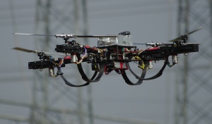
Image:Quadrotor.jpg |
| Description: | Visual navigation is becoming more and more important in the development of unmanned aerial vehicles (UAV). The goal of this thesis/tesina is to review in a structured way the current state of art in the field from different perspective: research teams, projects, platforms, tasks, algorithms. The latter is the most important aspect obviously and the project should provide a clear view on what is done today, and obtaining which results. Two kind of operations are of most interest: tracking of fixed and mobile targets (and how this impact on the UAV path), navigation on a geo-referenced map. Implementing one of the standard approaches on a mini unmanned aerial vehicle would be the ideal ending of the work to turn it into a thesis.
Material:
Expected outcome:
Required skills or skills to be acquired:
| |
| Tutor: | MatteoMatteucci (matteo.matteucci@polimi.it) | |
| Start: | 2015/01/01 | |
| Students: | 1 - 2 | |
| CFU: | 10 - 20 | |
| Research Area: | Robotics | |
| Research Topic: | none | |
| Level: | Bs, Ms | |
| Type: | Thesis | |
| Status: | Active |
